
Large Unrestricted Lot
w/ Power & Underground Utilities
w/ Power & Underground Utilities
To get a better sense of the property, we encourage you to scroll to the bottom of this page where you can view a drone video of the land.
Price: $35,000.00
Earnest Money Deposit: $500.00
Earnest Money Deposit: $500.00
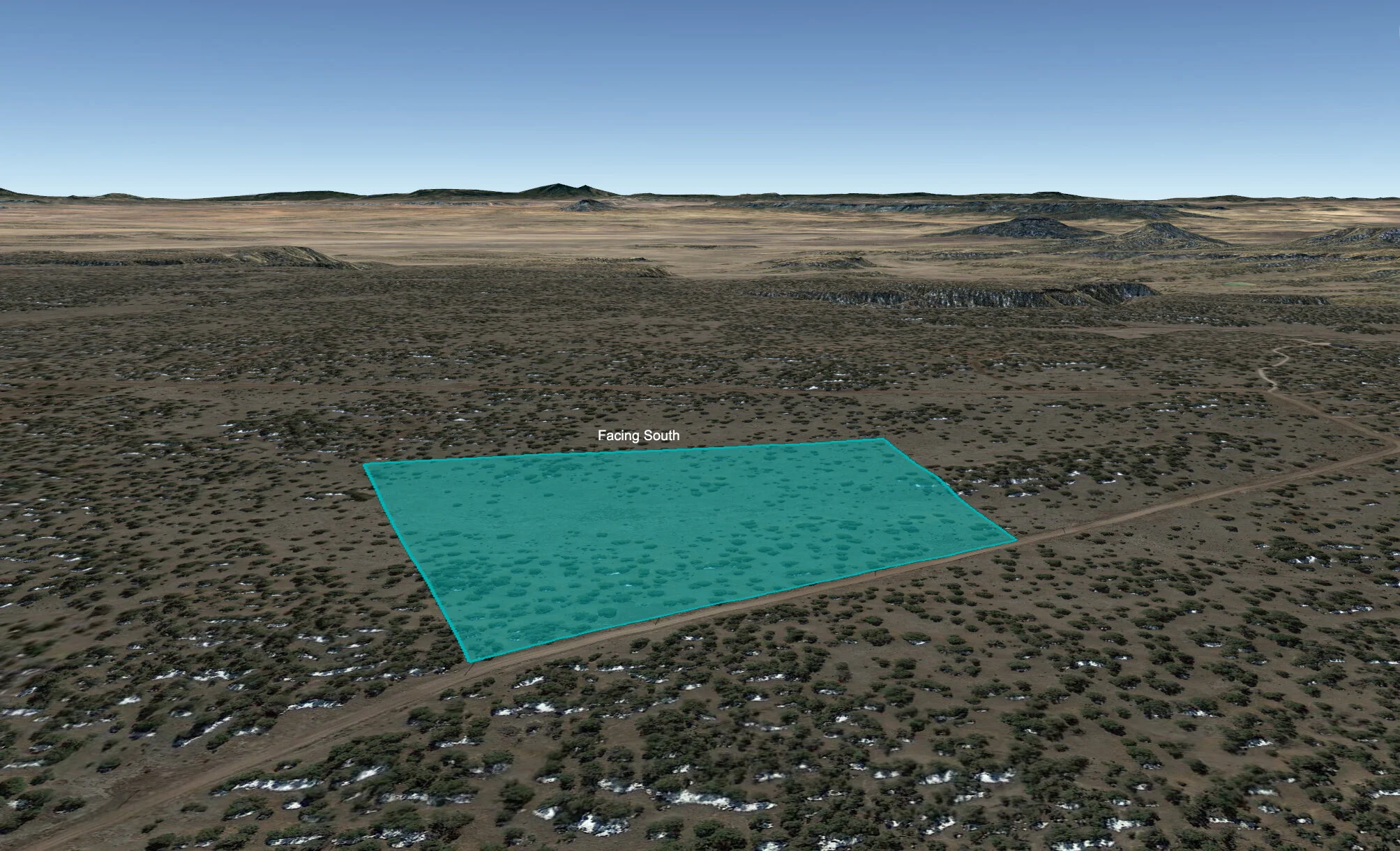
- This 20 acre parcel is situated just south of Highway 36 along Elk Run Trail in the Indian Knolls subdivision. The subject property has roughly 973 feet of dirt/gravel road frontage along its northern boundary, all of which is well-maintained and can be navigated by any vehicle type. While it’s safe to assume that one would want a larger truck or off-road capable vehicle in winter months, one of the nice things about this property is that even in inclement weather, given its proximity to the main Highway, you will not have far to drive before coming to state maintained roads. Click here to see the subject property's location on Google Maps.
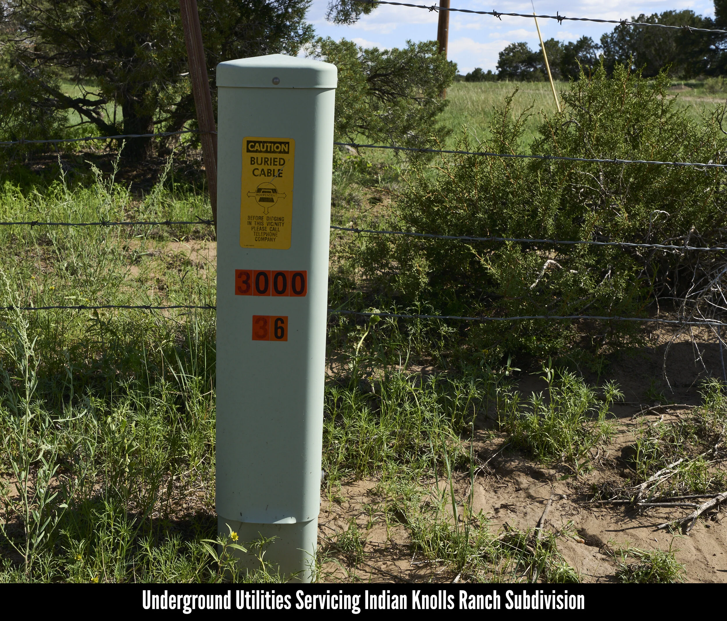
- Like much of the Indian Knolls subdivision, the subject property boasts power and underground telecom lines along its northern border. This should make building on the land and getting power to the eventual home site both easier and more affordable. Anyone curious to investigate the cost involved with connecting to the grid is encouraged to contact Continental Divide Electric Cooperative, the utility company servicing this region.
- The Indian Knolls subdivision has no HOA and no annual dues. While there are covenants and restrictions that were recorded when the subdivision was first created, they are what we like to refer to as "common sense, good neighbor" restrictions dealing primarily with the disposal of trash and prohibitions on excessive noise. In other words, nothing too strict. To learn more about the Indian Knolls covenants and restrictions you can read the attached PDF here or view the video at the top of this page beginning at 15:03.
- While there is fencing along the southern and western ends of this parcel, it should be noted that there is no fencing along the eastern length of the property boundary. Because of this, anyone planning to house livestock here will need to fence their own perimeter.
- As with most of the rural land we list, city water service does not exist in this region and anyone electing to develop the land will need to install a well. Applications for well drilling permits and water right are handled by the Office of the State Engineer. Anyone curious to learn more about this process is encouraged to visit their website here.
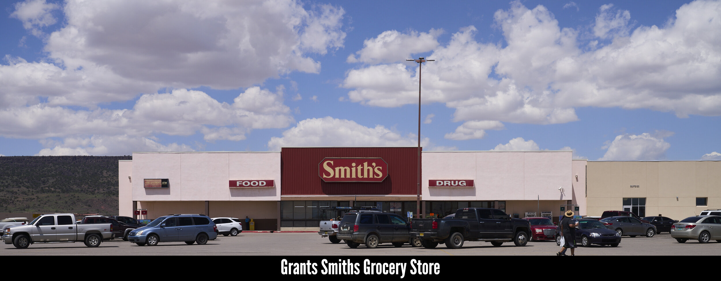
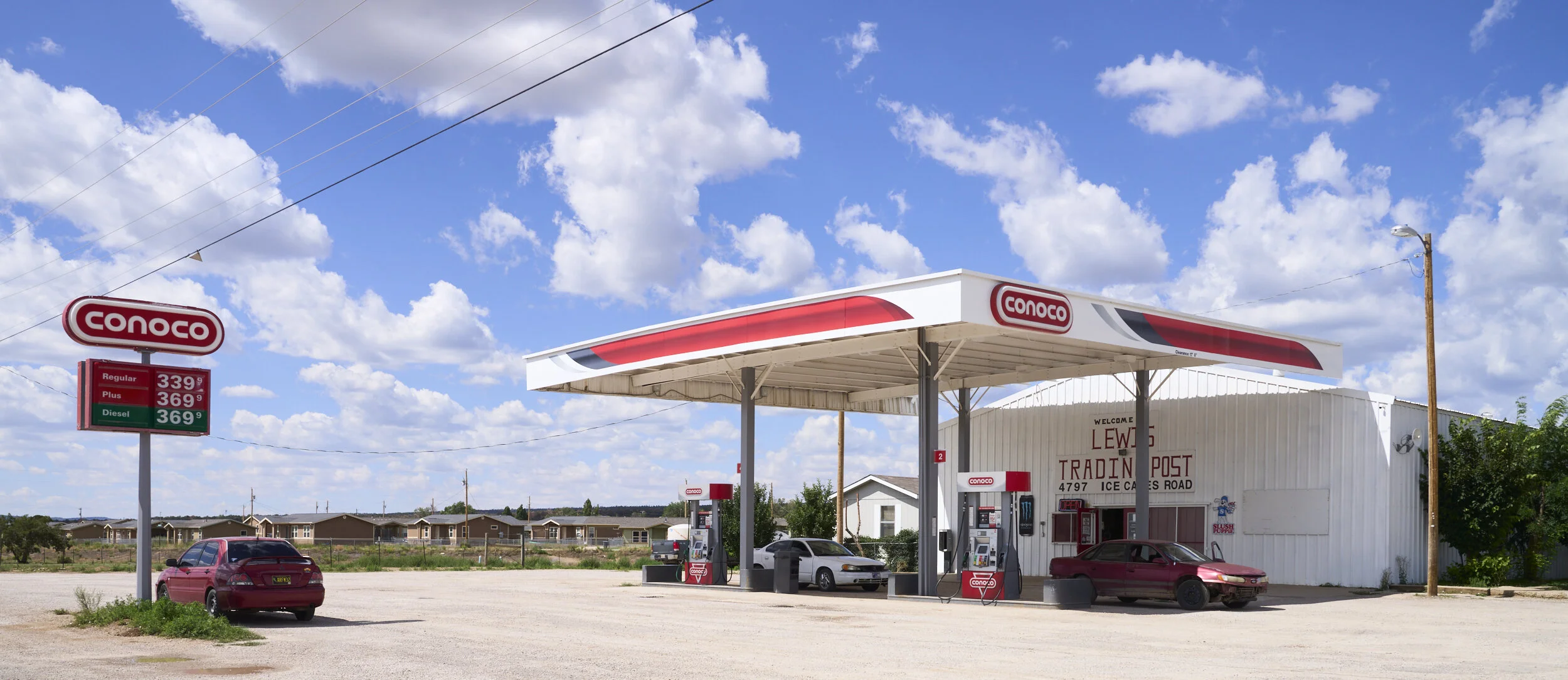
- While the nearby town of Fence Lake boasts some convenience and supply stores, the towns of Quemado (thirty minutes south of the land) and Ramah (thirty minutes north of the land), may be the best bet for groceries and supplies. In addition, the county seat of Grants is located a little under an hour away along Highway 117. There you’ll be able to find big box stores such as Walmart, most all fast food chains, schools, churches and hospitals as well as the Grants-Milan Municipal Airport. For pictures of the aformentioned towns, please view the photo gallery at the bottom of this page.
- Aside from the 20 acres that comprise the subject property, the land also sits in close proximity to the 300,000 acres that make up the Cibola National Forest. Here you’ll be able to hunt elk, mule deer and wild turkey to name just a few of the many species that call this area home. Additionally, the Cibola National Forest also features plenty of great hiking trails and camping spots to explore.
- In addition to the Cibola National Forest, there are a number of scenic National and State Parks within easy driving distance of the subject property. Those parks include - but are not limited to - the El Malpais National Monument, El Morro National Monument, Bluewater Lake State Park, Ramah Reservoir, the Ice Caves & Bandera Volcano and pictured in the gallery at the bottom of this page, Quemado Lake.
- This property was closed on an its title insured through Quest Title Company.
- NOTE: We are requesting an upfront Non-Refundable Earnest Money Deposit of $500.00. This is not an installment sale and there is no financing offered. This is a cash transaction. After we have your Deposit we will contact you about how to proceed with finalizing the purchase, whether it be by credit card, wire transfer or title & escrow. If you elect to close through escrow, buyer will be responsible for all closing costs.
- For those wanting to learn more about the buying process and the various ways we can close this transaction and transfer title into your name, please visit our How It Works - Buying From Us Page. For those unfamiliar with what a title company does, please visit our Title/Escrow Frequently Asked Questions page. This page goes into greater detail about the process of closing a transaction through title and escrow, answering all the common questions we typically get from our buyers.
| Reference Number | CBNM-7643C |
|---|---|
| Location | Cibola County, New Mexico |
| Lot Size | 20 Acres |
| Available Financing | Click Here To Read About Financing Options |
| Legal Description | INDIAN KNOLLS RANCH, LOT 48 |
| Parcel Number | 2093027280267 |
| Account Number | R21442 |
| Latitude-Longitude | Center: 34.645590,-108.544997 |
| NW: 34.6456503020832,-108.547125743851 | |
| NE: 34.6474604088882,-108.544731670368 | |
| SW: 34.6438565019739,-108.547177953343 | |
| SE: 34.6445513966836,-108.543551633616 | |
| Annual Taxes | $107.00 |
| HOA/POA | None |
| POA Regulations | CCRs PDF |
| Zoning | No Formal Zoning Designation |
| Time Limit To Build | 12 Months From Ground-Breaking |
| Access | Well-Maintained Dirt Gravel Roads |
| Power | At The Lot Line; Solar or Alternative |
| Phone | Underground Telecom Lines; Mobile or Satellite |
| Water | By Well or Holding Tank |
| Sewer | By Septic |
| Elevation | 9,307 ft |
| Conveyance Document | Warranty Deed |
| Type of Closing | Title/Escrow |
| Doc Prep Fee | Waived |
| Nearby Towns | Grants: 74 miles (1 h 17 min) |
| Gallup: 72 miles (1 h 14 min) | |
| Albuquerque: 137 miles (2 h 11 min) | |
| Los Lunas: 138 miles (2 h 19 min) | |
| Rio Rancho: 142 miles (2 h 18 min) | |
| Points Of Interest | El Morro National Monument (Link) |
| El Malpais National Monument (Link) | |
| Acoma Pueblo (Link) | |
| Wild Spirit Wolf Sanctuary (Link) | |
| San Estevan Del Rey Mission Church (Link) | |
| Ice Cave & Bandera Volcano (Link) | |
| County Contact Info | Cibola County Assessor's Office (505) 285-2526 |
| Cibola County Planning & Zoning (505) 287-9431 | |
| Continental Divide Electric Cooperative (505) 863-3641 | |
| New Mexico State Engineer 1-800-WATERNM | |
| Well Drilling Info (Link) | |
| Well Drilling Permit Application (Link) |


Price: $35,000.00
Earnest Money Deposit: $500.00
Earnest Money Deposit: $500.00
Disclaimer: While The Hemingway Land Company does extensive research on all our properties prior to listing them, there are always County-specific rules/regulations we will not be aware of. The information provided on this page is, to the best of our knowledge, correct. All prospective buyers, however, are encouraged to contact the county at the links and numbers provided in this table to confirm that whatever plans that buyer has for the property in question are in fact legal, feasible and permitted. Due diligence is the buyer’s responsibility and all sales are final.